

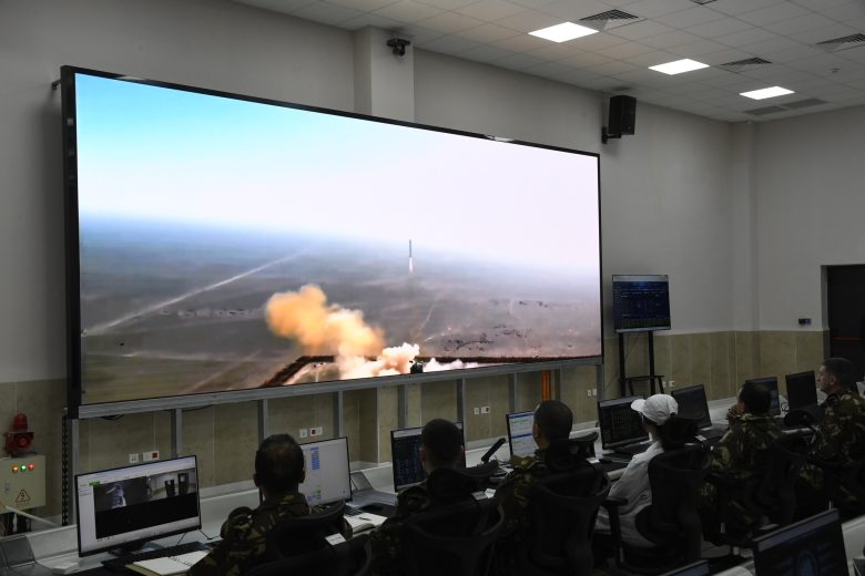
Army General Saïd Chanegriha, Delegate Minister to the Minister of National Defense and Chief of Staff of the National People’s Army, supervised this Saturday the launch of the Alsat-3B satellite, confirming the enhancement of the national high-resolution Earth observation constellation. This was announced this Saturday in a statement from the Ministry of National Defense (MDN).
Continuing the national effort to strengthen and develop space surveillance capabilities, Army General Saïd Chanegriha followed the launch operation of the second satellite in the Alsat-3 constellation, named Alsat-3B, from the remote sensing ground station. This operation completes the full structuring of the national high-precision Earth surveillance system, designed to ensure greater strategic autonomy in this sensitive domain.
Upon arrival, the Chief of Staff was welcomed by Major General Ali Sidan, Commander of the 1st Military Region. He then attended detailed technical briefings on the missions, capabilities, and performance of the Alsat-3B satellite, in the presence of the Ambassador of the People’s Republic of China, Dong Guangli, the Director General of the Algerian Space Agency, the Inspector General of the ANP, and several high-ranking civilian and military officials.
The actual launch of the Alsat-3B satellite took place at 5:01 a.m. local Algerian time, corresponding to 12:01 p.m. Beijing time, from the Jiuquan space base in northwest China, less than a month after the successful launch of the Alsat-3A satellite from the same base.
The total success of this second orbit insertion in such a short timeframe represents a notable technological achievement and confirms the strength of the Algerian-Chinese partnership in the space domain, while reflecting the growing maturity of national expertise mobilized.
Following the operation, Army General Saïd Chanegriha delivered a speech in which he conveyed the congratulations and encouragement of the President of the Republic, Abdelmadjid Tebboune, Supreme Commander of the Armed Forces and Minister of National Defense, who “has shown particular interest in this project and closely followed all its preparation and implementation stages,” he stated.
——— Achieving Lasting Mastery of Space Technology
The ANP Chief of Staff also extended his congratulations to the executives and personnel of the Algerian Space Agency, as well as the various structures of the National People’s Army that contributed to the success of these strategic projects, urging them “to ensure optimal exploitation of the knowledge and expertise acquired, in order to guarantee total mastery of these satellites, both in terms of operation and surveillance of their systems.” He also emphasized the imperative to continue developing national space technology to embed these achievements durably.
Furthermore, the Army General stated that these accomplishments represent a new step in the trajectory of building victorious Algeria, within an overall dynamic of development and sovereignty in its decisions and choices. He affirmed that “these achievements fully align with the process of building victorious Algeria, akin to the major structuring projects the country will undertake, particularly at Gara Djebilet, with the commissioning of the Béchar-Tindouf railway line, set to play a determining role in valorizing this strategic deposit.”
The Chief of Staff concluded his speech by expressing his gratitude to the People’s Republic of China for the quality of bilateral cooperation in the space domain, as well as in other structuring projects contributing to Algeria’s dynamic of development and progress.
For reminder, on January 15, Army General Chanegriha had supervised, at the same remote sensing ground station site, the launch operation of the Alsat-3A observation satellite. The MDN had then indicated that this launch enabled Algeria to acquire additional data through high-resolution satellite observation capabilities, while strengthening the geospatial intelligence and high-value geospatial information system, particularly in cartography.